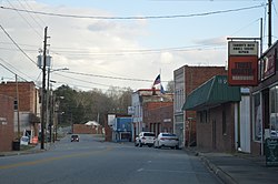
Drakes Branch, Virginia
Drakes Branch, Virginia | |
|---|---|
 | |
 Location of Drakes Branch, Virginia | |
| Coordinates: 36°59′35″N 78°36′6″W / 36.99306°N 78.60167°W | |
| Country | United States |
| State | Virginia |
| County | Charlotte |
| Area | |
• Total | 4.14 sq mi (10.72 km2) |
| • Land | 4.14 sq mi (10.72 km2) |
| • Water | 0.00 sq mi (0.00 km2) |
| Elevation | 384 ft (117 m) |
| Population (2010) | |
• Total | 530 |
• Estimate (2019)[2] | 501 |
| • Density | 121.07/sq mi (46.75/km2) |
| Time zone | UTC−5 (Eastern (EST)) |
| • Summer (DST) | UTC−4 (EDT) |
| ZIP code | 23937 |
| Area code | 434 |
| FIPS code | 51-23376[3] |
| GNIS feature ID | 1465943[4] |
| Website | www |
Drakes Branch is a town in Charlotte County, Virginia, United States. The population was 530 at the 2010 census.[5]
Geography
[edit]Drakes Branch is located southeast of the center of Charlotte County at 36°59′35″N 78°36′6″W / 36.99306°N 78.60167°W (36.992958, −78.601714).[6] Virginia State Route 47 passes through the town, leading north 5 miles (8 km) to Charlotte Court House, the county seat, and southeast 7 miles (11 km) to U.S. Route 15. Virginia State Route 59 intersects Route 47 in the north part of town and leads northeast 8 miles (13 km) to Keysville.
According to the United States Census Bureau, Drakes Branch has a total area of 4.1 square miles (10.7 km2), all of it land.[5]
Demographics
[edit]| Census | Pop. | Note | %± |
|---|---|---|---|
| 1880 | 87 | — | |
| 1910 | 703 | — | |
| 1920 | 660 | −6.1% | |
| 1930 | 583 | −11.7% | |
| 1940 | 438 | −24.9% | |
| 1950 | 410 | −6.4% | |
| 1960 | 759 | 85.1% | |
| 1970 | 702 | −7.5% | |
| 1980 | 617 | −12.1% | |
| 1990 | 565 | −8.4% | |
| 2000 | 504 | −10.8% | |
| 2010 | 530 | 5.2% | |
| 2019 (est.) | 501 | [2] | −5.5% |
| U.S. Decennial Census[7] | |||
At the 2000 census there were 504 people, 231 households, and 134 families living in the town. The population density was 121.8 people per square mile (47.0/km²). There were 262 housing units at an average density of 63.3 per square mile (24.4/km²). The racial makeup of the town was 59.33% White, 40.08% African American, 0.20% from other races, and 0.40% from two or more races. Hispanic or Latino of any race were 1.98%.[3]
Of the 231 households 21.6% had children under the age of 18 living with them, 39.0% were married couples living together, 14.3% had a female householder with no husband present, and 41.6% were non-families. 35.5% of households were one person and 14.7% were one person aged 65 or older. The average household size was 2.18 and the average family size was 2.81.
The age distribution was 20.4% under the age of 18, 6.5% from 18 to 24, 24.4% from 25 to 44, 28.4% from 45 to 64, and 20.2% 65 or older. The median age was 44 years. For every 100 females, there were 88.8 males. For every 100 females age 18 and over, there were 91.0 males.
The median income for a household in the town was $25,583, and the median family income was $35,000. Males had a median income of $25,469 versus $17,500 for females. The per capita income for the town was $15,701. About 8.2% of families and 16.8% of the population were below the poverty line, including 20.5% of those under age 18 and 14.3% of those age 65 or over.
References
[edit]- ^ "2019 U.S. Gazetteer Files". United States Census Bureau. Retrieved August 7, 2020.
- ^ a b "Population and Housing Unit Estimates". United States Census Bureau. May 24, 2020. Retrieved May 27, 2020.
- ^ a b "U.S. Census website". United States Census Bureau. Retrieved January 31, 2008.
- ^ "US Board on Geographic Names". United States Geological Survey. October 25, 2007. Retrieved January 31, 2008.
- ^ a b "Geographic Identifiers: 2010 Demographic Profile Data (G001): Drakes Branch town, Virginia". U.S. Census Bureau, American Factfinder. Retrieved August 25, 2015.[dead link]
- ^ "US Gazetteer files: 2010, 2000, and 1990". United States Census Bureau. February 12, 2011. Retrieved April 23, 2011.
- ^ "Census of Population and Housing". Census.gov. Retrieved June 4, 2015.


